|
|
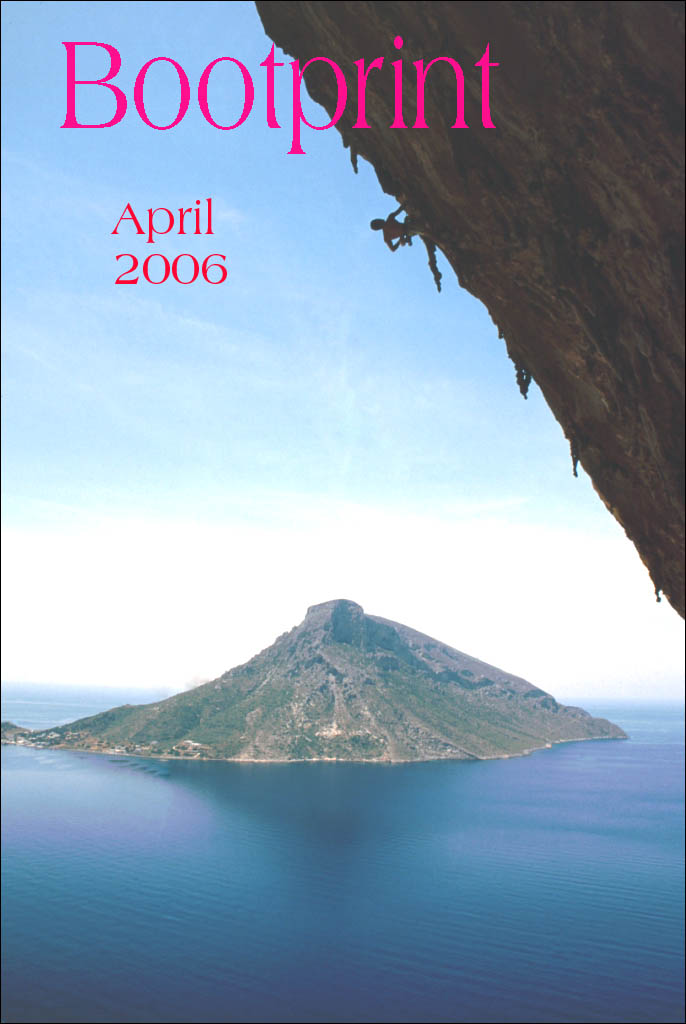
Bootprint Online - April 2006
The offical newsletter of Vibram Mountaineering Club
Link to the previous
Bootprint
I am just back from a month in Morocco, I hope I haven't missed any
emails. It was an uneventful trip but I did spend a few days in the
Atlas Mountains and if I don’t get enough material for the next issue I
may tell you the story of the 15 egg omelette.
In this issue we have a brilliant piece from Phil Roberts. As far as I
can make out he is a mate of Alan Hartley who was coerced into the
Vibram team for the this year’s High Peak Marathon. Alan will probably
have grounds for sueing us for libel after reading it. Instead he can
buy Phil a drink and claim the money back from Alison.
Anne has contributed an interesting article on the development of
Vibram ski touring. Ian has promised me he will write up their trip to
Sweden. There’s no hurry Ian, take your time.
I got our Abby to write this month’s Kookery Korner as part of her
revision for her English SATS. It was very good although I had to add
some punctuation – don’t they teach things like commas and capital
letters in school any more? Next time we will have some maths. If it
takes a Vibram member five hours to climb Snowdon from Rhyd Ddu, how
long will it take five members? Answers on a postcard please.
Many thanks for this months articles and keep them coming in.
Stuart Clarke (stueclarke@aol.com)
There was a committee meeting on February 28th:
Ollie was annoyed because caving equipment was not being returned to
him after use. The cheque to the British Caving Association has been
cashed.
The revamped website is up and running. Both Chris and Alan now have
access so it should be much easier to keep it up to date. The new
design was considered a great success. A members’ only area will
probably be added for such things as address lists.
Alison said that she currently had 37 subs renewed. The dinner was
subsidised to the tune of £18.75. Meets so far this financial
year have made a loss of £138.
The library has acquired the Millstone Edge guide. There is also a
Winter Skills DVD and some kind of skiing DVD available to borrow.
There was some talk about acquiring digital maps and Phil is going to
firm up a proposal and submit it to the committee for decision.
The dinner at the Railway Inn, Ribblehead, was a success - 34 people
went of whom 30 ate. There was a trip down Sunset Hole on the Saturday
and good walking on both days. There was a lot of criticism of the
accommodation but the food was good. Jacqui is already looking for a
venue for next year. The raffle raised £30 although not all the
winners seemed to appreciate their prizes! The photo competition
attracted lots of entries. The landlady of the Railway was the judge
and awarded Andy Wardman first prize for a stunning photo of a climber
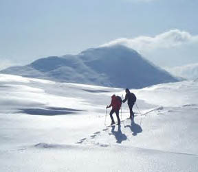
on Aeglialis (7C) at Grande Grotta on the Aegean island of Kalymnos.
Ann was second with a picture of ski tracks and Phil third.
Day meets are still proving popular and it is hoped to combine one with
a curry evening in the near future.
This year’s Vibram barbecue will be held at Matt and Lisa’s in Totties
on September 2nd. Matt has suggested that there might be a Vibram
Orienteering event on the day (he has written a piece on Orienteering
that has been held over until the next issue). More details will be
available nearer the time.
Alan has sent round an email asking for suggestions for future hut
meets. He gives some useful links:
www.thebmc.co.uk
www.mountaineering-scotland.org.uk
www.independenthostelguide.co.uk
www.hostel-scotland.co.uk
Please let him know if you have any suggestions, and also any dates
that would not be convenient.
Present: Alan W, John G, Ian P, Janet, Ollie, Stuart, Sarah, Abby,
Nick.
Saturday, Alan & Ian
A few breaks were seen in the clouds over breakfast and a little snow
capped the surrounding peaks. We had to go up Yr Wyddfa, but which way?
From the hut we crossed the railway (no sign of any Santa Trains) and
followed the track eastwards. Yr Aran looked good and so formed our
first objective. Behind us Mynydd Mawr, Mynydd Drws-y-coed and Mynydd
Tal-y-migned all looked very seductive in their dark shadows, colourful
flanks and sugar coated tops. The moon was still setting to the NW
while the sun worked on the clouds, fragmenting them if not entirely
dispersing them. No amount of sun was going to warm the day and the mid
December freeze refused to relinquish its dominance over 2000 feet.
As one approaches Bwlch Cwm Llan there are some nice quarry pits to
peer down before cutting up the slopes west of the summit of Yr Aran.
Lovely views and lighting effects were enjoyed on the 747m summit
(Boeings’ inspiration perhaps?) before descending eastwards and then
northwards to complete the traverse. Following the wall down one comes
to a stile near Bwlch Cwm Llan. Having crossed it you find yourself
having to negotiate first water and bog, followed by cliff. The siting
of the stile is difficult to explain, and it wins today’s “Stile
Without Style “ award. Needless to say, it is much easier not to use
the stile.
Elevenses were enjoyed on the sunny slopes of Allt Maenderyn, and then
a (disfunctional) path followed up to the summit of Snowdon, where we
met John having lunch. It was too cold to linger so we made our way
north to the Snowdon Ranger path and had lunch above Llyn
Ffynnan-y-gwas. The winter lighting and low sun still amazed me with
nature’s wonderful colours and textures, each land form seemingly
brought out to its annual peak.
A wiggley path was then followed south to finish the day, passing
through some slate tips and back to the village of Rhyd Ddu. - Ian
A perfect day for the hills – provided you were equipped for the cold –
above all with the right gloves or mitts. High up – where in places (on
a simple ascent/descent by the Rhyd Ddu path) the wind was very strong
& the wind chill factor very marked (I speculated that it felt like
about 10 degrees of frost) – I resolved to re-equip before any similar
trip. My “Dachstein” mitts must be nothing of the sort, and I needed
continual resort to the traditional means of restoring warmth to
freezing fingers. I had marvelled at Ian & Alan’s speed of ascent,
not knowing that the two distant ‘Mallory & Irvine’ specks must
have been others, just visible against the higher level snow-covered
slopes. Once above the snow line and through the other-sort-of-stile in
the stone wall (too tight to get through without removing the rucksack)
the view of the steep slopes below the station “hotel” opened up.
Dramatic and forbidding to a degree! (Except for the building it could
have been some great Himalayan peak – ten times the height.) About
twenty people sheltering from the wind, and half a dozen clinging to
the summit trig point. There are two sets of stairs up to the narrow
platform, and after five minutes at the top, I found myself unable to
return by the northerly one, which I’d taken to be the safer one.
Fortunately a younger fellow – last of those taking the southerly steps
– spotted my failing attempts to brave the gusting powerful wind &
treacherously slippy surfaces and encouraged me to descend into the
immediate shelter on the other side – surprisingly calm & safe.
Various encounters both going up (7 start and stop OTC Notts University
students passed me about four times from near the start till near the
top) and (two other ‘soloists’) going down added interest.
I think this was only my second ascent from the Rhyd Ddu/ Snowdon
Ranger side of Snowdon – the last one with a school friend about 55
years ago. Not quite the most perfect ascent – once four of us did an
exciting traverse of Grib Goch on a cloudless and I think windless day
when it was totally iced up and hardly any one else around. That was in
February – perhaps 25 years ago. - John G.
12 Vibram MC 29 190 Veteran 13:25:30
Four men and a tent .... and one sleeping bag
The things club mates can get you into!
If you think being persuaded by Tony Pritchard to do a Mid-Lancs Cross
Country in a blizzard in Cumbria is the sort of thing I mean, then
think again. Al Hartley can seriously dob you in it!
Think Peak District bog! Think foot deep snow! Think minus ten! Think
42 miles! Yes, 42 miles! There’s no decimal point! Think 15 pound
rucksack! And finally, think night! Yes, that’s the time of day when
sane people are safely tucked up in their beds!
Welcome to the 32nd Annual High Peak Marathon, a night-time fell race
for teams of four held on the night of the first Friday in March. Venue
Edale Village Hall. Start time 11.00 pm. An event challenging enough
for a man who can pull an 800 pound sled 1000 miles across Antarctica
to want to enter 5 winters in a row.
It would have been some compensation to know that Al Hartley was also
experiencing the worst night of his life, but unfortunately an old war
wound prevented him from starting. Lucky Al. I hope his dreams were
sweet that night! My nightmare began driving through a snow storm just
to get to Edale. Arriving there early with thick snow on the Village
Car Park, I huddled in the Village Hall eating comfort food and meekly
awaiting my fate; and the team mates’ who I had never met before in my
life. Secretly hoping they would not arrive! When finally they shouted
my name 30 minutes before the off, I realised I had been sitting next
to them for the last hour, listening to their tales of doing the ‘Bob
Graham Round’ or completing the ‘Tour Mont Blanc’ in 30 hours or
hallucinating on 36 hour ‘Adventure Races’. How on earth was I
embarking on a race with these fearsome men? Men who share experiences
on the Noticeboard of a web site called ‘Sleepmonsters.com’. Al
Hartley, you bastard!
So with little formal ado, apart from sharing out the mandatory
survival gear for a night-time navigation of 42 miles of bleak
snow-covered moor, we were off. Four complete strangers - only Al
Hartley actually knew any of us, you understand! Waterproofs, First Aid
kit, extra cloths, food and drink, map and compass, survival bag, head
torches. A tent big enough for all of us! And a sleeping bag for the
first to collapse with exhaustion and exposure. You can guess who I had
my money on! Four men and a tent ... and one sleeping bag.
So off we ran into the cold night air. Each team at one minute
intervals. Matt, Chris, Eddy and me. Stay together in case of accident.
Find your own way to 20 checkpoints. In the dark! On the Dark Peak! Bog
simple! Definitely so. Especially as Matt, Al’s mountaineering friend,
was a local and knew the route. One black mark erased from Al’s account
then. And then we hit the ice at the top of the gully off Win Top!.
Have you ever tried to walk down a bob sleigh run or a ski jump schuss
in your carpet slippers and with a Petzl on your head? Know what I
mean! Al Hartley you tripple-crowned, three-starred, treble-topped,
thrice-generationed, tri-alloyed bastard.
And just when you thought one couldn¹t get more venomous towards
an erstwhile club mate, the real fun was yet to begin. At least they
were paths I had bruised and battered myself on in the early section of
the ‘race’. After reaching the aptly named Cutthroat Bridge, we headed
off onto the trackless tops of Derwent Moor, Margery Hill and Bleaklow.
The atmosphere distinctly chilled and all the clothing I possessed came
out of the rucksack and onto me. And rather predictably, but not by me
alas, the 2-litres of water in my Platypus ominously began to freeze,
and the alkaline batteries in my torch more ominously began to dim.
What a night! A night of slow, dehydrated progress. A night of eerie
grit stone crags set against a moon less sky. Islands of head torches
bobbing in the immense blackness, some unknowable distance away. The
sight of the next tented checkpoint appearing out of the gloom. The
glimmer of a space blanket being unrapt to protect a broken legged
competitor awaiting his 3 am rescue by a Sea King helicopter. Please
bring on the dawn. If only I can make it till dawn, then I’ll be right.
Another 3 hours of night. And then only another 6 hours in the light.
If only I can get through the night I can make it to the finish. Past
the Outer Edge checkpoint at 5.20 am, the last before the morning, the
million lights of Manchester below. And then the utter relief of the
pre-dawn light reflected against the featureless snowy plateau.
Unfortunately, the crack of dawn isn’t all it’s cracked up to be.
Especially, when picking your way through hour after hour of snow
filled gullies and peat hags. Things only improved when we hit the
Snake Pass road at 9 am. By that time my platypus had actually
defrosted and the ‘path’, i.e. the Pennine Way under hard pack snow,
became runnable. Only then did I know that it was possible to finish
this brute of a race. As the four of us settled into an ultra
marathoners trot, the last 13 miles breezed by. Well, perhaps a slight
exaggeration, with the climb and traverse of Kinder Edge to come. Mind
you rather me than the ice climbers on the frozen Downfall that we
spied in the cold morning sunshine.
Finally, we rounded Brown Knoll and onto Rushup Edge, the village of
Edale came into view, and the finish beckoned. Just a traverse of Mam
Tor and the final icy descent now. How those thighs ached! How that bum
hurt! Then half a mile together on the road and we were home intact.
12th team home out of 26 finishers and 50 starters. 42 miles in 13 1/2
hours. 2 1/2 hours behind the winners. And 1 hour behind ‘the world’s
greatest explorer’ who can run 7 marathons in 7 days in 7 continents 5
weeks after a triple heart bypass.
Was this the worst night of my life? In my mono-syllabic exhaustion
back at the village hall I thought so. Would I ever do something so mad
again? Not then. But now? In hindsight. What do you think?
Thanks Al for getting me into something I’d not have dreamed of. I only
wish you’d been there. Next year, perhaps?
Phil Roberts. - Al Hartley's mate & a member of the Vibram MC team
Present: Alan, Andy H, Gilly, Nick, Phil, Jacqui, Dave P, JT, Bridget,
Ian, Helka, John G.
Parked the cars by the side of Bass Lake, just south of the Ravenstone
Hotel. Steeply up the side of the growds, then diagonally left and
right to reach the ridge of Ulloch Pike. Magnificent views until we hit
the cloud at about 700m. A detour over the tussocks to bag Carl Side,
then a long slog up shale slopes onto the summit ridge of Skiddaw.
North to the summit, then back again and down to the SE till we met the
fence, then follow that to the summit of Little Man. Down to the
tourist path from Keswick, where Nick left the party to walk back to
the hut. Another long traipse up to the boring and featureless summit
of Lonscale Fell, a detour to the craggy viewpoint of the East Peak –
the clouds were now lifting and we had good views of the “Big Country”
Back o’ Skiddaw. Everyone now followed a faint track North Westward
until we crossed a fence, then we all made our own way, picking
different routes, some taking a more direct route, others contouring
and following sheep tracks, until a snack break by the side of Stile
Gill, until we re-united on the top of Sale How – another of Jacqui’s
ticks, where there was some discussion as to which of the slight lumps
was the true summit. Jacqui’s guide book then took us down to Skiddaw
House (closed and with most of the old trees dead or blown down, though
with a lot of new ones planted). Then along the landrover track, part
Whitewater Dash, to a gate in a wall, where we turned right to follow
it back to the car. There was a distinct lack of footpath, across the
slopes, which left us all feeling a bit like Haggises. After a long and
weary slog we got back to the car just as the sun was setting. One car
went straight back to the hut, but the other had to pop into Keswick –
Phil & Jacqui were still taking malaria tablets after their trip to
Equador, but had left them at home. Minimum quantity was 98 tablets
though. – Alan.
Last to leave the hut, the weather showed plenty of promise as the sun
lit up the flanks on the Grasmoor group. John G went off to Causey Pike
leaving Helga and I to follow the path from Skelgill to Little Town
(still little, even today!) and the tarmac to Low High Snab. The first
snowdrops were showing themselves – an added bonus on a January day. We
took a hot water break on High Snab Bank and then carried on to
Robinson for a late lunch. Typically, mist rolled in as soon as I got
my camera out for a summit photo and rolled away as soon as we left the
summit. For the next hour clouds came and went at all elevations making
for some very interesting lighting conditions looking towards the hazy
sun. On Dale Head we finished of the flask and gazed at hills queuing
up in the distance. Today there was no wind and conditions were very
pleasant. The only snow present was a couple of specs on Great End.
Reluctantly we headed down to Dalehead Tarn and then down to the valley
bottom, though I’d have liked to stay up to watch the sunset. – Ian
Sunday.
Gilly and I were away from the hut at 8:20 am, heading for an
orienteering event starting from the SW corner of Thirlmere. Newlands
Valley was all bright and clear, with frosty fields as we drove up past
the Swinside Inn. However, it all got greyer and gloomier as we drove
South from Keswick, and by the time we parked up the clag was down to
almost lake level. Lovely visibility to be tackling 14 controls!
After registering and gearing up, Gilly set of for the start at the top
of the forest, followed 7 minutes later by me. We both chose the same
courses, the second longest of a choice of 4 routes, at 12 kilometres
according to the program and 10 + as listed on the map.
The clag lifted once for about a minute but otherwise it was thick grey
stuff all the way, so precise navigation was the order of the day
rather than fast trotting. About half the controls were on the open
fell towards and around Blea Tarn, the rest scattered in very rough
forestry above the car park. We both completed the course and got back
to download our “dibbers” and grab the coffee and doughnuts that were
included in the entry fee. Quite satisfying to have completed the
course without major foul-ups given the conditions.
Andy 3hours 5Mins, Gilly 3hours 31.
(Note – Gilly’s just added the time at the bottom of what I’d written-
I wasn’t going to mention the times as I’m sure I’ll get my
come-uppance the next time we’re in the same event!) – Andy.
Ian, Helka.
From the hut to Rowling End Farm, and up to Rowling End for a nice hot
cuppa & lovely views. Then on to Causey Pike before dropping down
to Rigg Beck for lunch. Easy walking down to the road where by chance
Alan offered us (accepted) a lift to the hut for more tea.
And from Jacqui:
Saturday: I laid my plans on the table on Friday night for walking
around the tops on the Skiddaw massif and was joined by Andy H, Dave P,
JT, Gilly, Bridget, Alan W and Nick. After I allowed them to negotiate
a slightly later start time of 8.30am (it was 13miles and 4550ft of
ascent in deepest winter!) we set off and got to the Ravenstone Hotel
about 9am. The guidebook warned of a steep path up the fell side to
begin with and they weren’t wrong. It was a very steep pull up onto the
ridge and then up over Ullock Pike (3ft too short to be one of my
mountains) and onward and upwards to Longside (Long Hill Slope,
2408ft). From here we had beautiful views over Bassenthwaite and out
towards the sea but we could see the clag looming ahead.
We continued on above Southerndale on pathless ground to the summit
cairn of Carlside (Karl’s Hill Slope, 2447ft). It was then a drop past
Carlside Tarn and rejoining the main path for a steep pull up the
Skiddaw slates in the clag. Most of the party had only been up the hill
approx. once every 30 years and now they remembered why. On the summit
of Skiddaw (Archer’s Hill, 3054ft) it was blowing strongly and the wind
was bitterly cold – I think this would have been an excellent
viewpoint, especially as the guide book claimed you could see West and
NORTH Scotland!
We didn’t hang about and headed down the hill to the col before Little
Man. We breaked here for late 11enses, of course the weather broke and
as Dave had predicted the cloud “burnt off” – more like blew off and we
had a view of the top of Skiddaw. We climbed alongside a fence to the
summit of Skiddaw Little Man (Little Hill With a Cairn, 2838ft). Here
Nick left us and headed down to Keswick and a walk back to the hut. We
continued on to Lonscale Fell (2346ft) and had a view of Skiddaw House
and our previous hills of the day. The next and last hill was an
innocuous bump Sale How (Hill Spur of the Sallows, 2185ft) we headed
over rough grass, skirting around the hill and stopped at Stile Gill
for lunch before heading up the steep grassy slope to the summit. All
on our own bearing but congregating on the top.
From here we dropped down to have a look around Skiddaw House, closed
up except for a small dank bothy room. (Looked on the Internet and the
Friends of Skiddaw House are trying to reopen it for Easter 2006 – bang
goes the café idea!). We then had a route march for a good few
miles past Whitewater Dash Waterfall and under Dead Crags before
another couple of miles traversing an undulating hillside on sheep
tracks back to the car. We got back in the light with time for a quick
shop in Keswick.
Only later did we find Phil had somehow lost his wedding ring somewhere
on the walk taking his gloves on and off – so if you’re up there in the
next few years keep you’re your eyes peeled !
Sunday: After some debate who was going were, Alan dropped JT, Dave
& Bridget off in Buttermere to walk back and met up with Phil and I
at Gatesgarth Farm at the top end of Buttermere. We walked across the
fields behind the farm where apparently One Man and His Dog was filmed
and headed up the diagonal path towards Scarth Gap. Once past High Wax
Knott we left the path and followed a broken wall steeply up onto the
ridge. Once here the wind picked up and the clag descended – no views
of Pillar today ! We climbed to the top of High Crag (2441ft) and
quickly dropped down to the col and back up the other side following
fence posts to the summit of High Stile (High Steep Ridge Path,
2648ft). The summit is actually the smaller cairn not the large main
one.
We were now in true clag and it took some navigation and a quick check
of the GPS to ensure we were on track for our next peak Red Pike (Red
Peak, 2477ft). The summit was bitingly windy so once we had relocated
Phil, who had gone to shelter in a hollow, we headed down the steep
eroded scree path. Within minutes we were out the clag and had entered
a tranquil calm world warm and no wind! After a short climb we summited
our last top of the day Dodd (Bare Round Hill, 2103ft) then continued
down to Bleaberry Tarn. We had been warned by the guidebook about the
path and it was all-true – the path above and below the tarn all the
way down to the lake edge was tortuous. It was very badly designed –
steps all sloping forward, slimy and uncomfortable sizes. You spent the
whole descent trying not to end up on your backside.
The return path along the lake made up for it though, the weather was
lovely and the views very pleasant back to the car.
Jacqui
A long. long time ago we bought a Hilleberg tent. The "showroom" was a
back garden near Hawkshead, and the saleswoman's other business was
organising nordic skiing trips in Sweden and Norway - for which
Hillebergs are supposedly ideal. After agonising over the price we
finally bought our Stalon, and went home with a handful of leaflets
full of pictures of wide-open snowy landscapes. The idea of skiing
without the crowds and machinery of the downhill resorts held great
appeal but we never got round to doing anything about it. Stalon was
used for cycle-touring and years later was joined by a Nallo for
backpacking, but skiing remained purely a downhill activity. Stalon and
Nallo were just odd names.
Enter Ian Parker, sometime in 2004, with his bright idea. His email
began:
A trip to Sweden is suggested for early April 2005. This timing allows
us to revel in a second ski holiday (but with a difference!), avoid the
Easter crowds, relax in 14hrs of daylight and yet still have a chance
of seeing the amazing Aurora Borealis.
We fell for it. Alison and Andy were also keen, making it a party of 5.
Although the original plan had been to avoid Easter we eventually
booked flights with SAS from Manchester on Good Friday. We were a bit
concerned about overcrowding in the huts on our intended route, but as
it turned out that was the least of our worries!
Between Christmas and New Year we joined Dave, John and Bridget for a
night at Braemar and spent an afternoon in Braemar Mountain Sports,
sussing out gear. We arranged to hire most of what we needed and
decided on traditional nordic skis, as owned by Andy and Alison, so
that we'd all be in the same wobbly boat! I did buy my own plastic
boots, a pair of Scarpa T4, as I didn't think I'd cope in soft leather
ones.
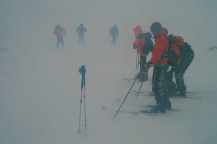
Cairngorms, February 2005
We arrived back from a week's downhill skiing on Sunday 6 February and
started organising ourselves for Sweden. By Wednesday 9 Jim had bought
himself a second-hand ski-mountaineering kit off e-Bay! (Not the wobbly
skinnes we'd agreed to use but by then Jim had changed his objectives.)
I tracked down a beginner's course on cross-country skiing due to take
place the next weekend and on Friday night we drove to Newtonmore, as
fresh snow fell on the Cairngorms.
Saturday morning, we met up with our group in the Cairngorm Mountain
Sports shop, Aviemore (what a great cafe!). Jim was the only one on
alpine skis, most of the rest of us hired nordic gear. One couple had
their own mini-skis - not as short as snow blades but very short. We
drove to the ski-area car park and then split into 2 groups, Jim and
myself being assigned to a bloke called Jas. Almost immediately we had
to put skins on the skis and we set off uphill - which was a weird
sensation. The snow was patchy, icy and wind blown in parts, tiny
drifts of fresh softer stuff elsewhere. We moved about trying all the
different surfaces, seeing how well the skins held. On steeper slopes
we traversed back and forth to gain height. We were reminded of the
downhill kickturn and practised the uphill version, slightly more
awkward but much safer-feeling.
In Coire an t-Sneachda we gathered for a huddled lunch and somewhat
wind-blown discussion on avalanche risk. Then we set off downhill,
which proved to be an unnerving experience. Straight, skinny skis do
not turn without a considerable amount of expertise. Steering seems
impossible! Free heels means it's easy to fall forwards, flat on your
face. While we realised all this, the weather turned foul. The wind got
up, the cloud dropped, and soon we were in a white-out (see the cover
of the April 2005 Bootprint). The intended session on technique became
an exercise in getting down safely as fast as possible. I reverted to
the snowplough, one bloke amazed us all by executing perfect telemark
turns, while Jim "cheated" and clipped his heels down and skied as
normal. The owners of the short skis found them very difficult to
control on the descent and had to walk down. So we made it back to the
carpark and then the cafe to talk over what we'd done and the options
for the next day.
By Sunday morning the area round Newtonmore was deep in snow. But it
was wet, and there was less of it at Aviemore. The two groups joined
together for a short tour, starting at Glenmore Lodge. The first
objective was Ryvoan bothy, a few kilometers up the valley. As the
route was only gently uphill skins were not required, instead we were
introduced to the black art of waxing. Conditions were less than ideal
- wet snow over patches of ice, all melting rapidly as the temperature
rose. But we got the idea and plodded along more or less happily along
a very pretty path, ignoring the fact that it would have been
considerably quicker to walk. Occasionally we hit a patch smooth enough
to try for the "kick and glide" pattern we were supposed to be
learning, but more often we were splashing through puddles and trying
to avoid the stones hidden in the slush. Lunch at the bothy was a
somewhat damp half-hour, over when we were invaded by a horde of wet
college students complaining that the place smelled (it hadn't until
they arrived.)
Perversely, the slush got worse the higher we climbed so we traipsed
back to Glenmore Lodge, taking the high line through the heather for
most of the way. Jim walked to preserve his skis while those of us on
hired gear scraped and scratched our way downhill to a perfect nursery
slope of good snow. There we fought for space with all the kids from
the surrounding area, numerous parents and a fair sprinkling of ski
instructors. Dodging the careering bodies we were encouraged to have a
go at the telemark turn, a weird action involving a lunge and a dropped
knee that looks as if it should take place in a gymnastic display.
Having resorted to the snowplough the previous day I was prepared to
give anything a go. Surprisingly enough, after an hour or so, all the
surviving members of the course were managing to steer their skis in
generally the required direction - not by perfect telemarks but with
various "adaptations", all of which worked to different degrees. There
was quite a sense of satisfaction by the time we packed up and returned
to Aviemore.
Back in the cafe we shared teas and plans of what we wanted to do next
- one lady was off buying skis, bindings and boots already! I decided
to stick with hiring what I needed for Sweden and Jim was sure that his
kit would do fine. As we drove home we agreed that the weekend had
served its purpose. The content was ok, although we'd been limited by
the conditions, and it had been a useful opportunity to get a feel for
the equipment.
Howden Moors 2005
Sunday 27 February
The cold weather spread south and we got our share of the white stuff.
Traffic reports of Woodhead and Snake passes being closed made skiing
nearer to home a possibility. Jim and I met up with Ian and Chris at
Salter's Brook bridge on the A628 (Woodhead road). The snow was patchy
lower down but Ian the eternal optimist said there was plenty of cover
on the tops, and he was right.
Alison had kindly loaned me her cross-country skis and poles - having
dislocated her shoulder on her previous downhill holiday she wasn't fit
for messing around in the Peak District. Jim and I had no wax but
Alison's skis have fishscales, which proved fine. Chris had applied
grip wax in his middle section and glide wax on his ends (!) and I
think Ian had just taken his skis out of the cupboard and skied as they
were but I could be wrong. For Ian it was his first outing on snow of
the year, whereas Jim, Chris and I had at least had some practice
recently. It proved to be a grand day out.
Ian's optimistic suggestions were to head for either the Snake Inn or
the pub at Strines, both of which were rather too far but did set some
sort of goal. First objective was Lady Cross, from where we headed west
via Featherbed Moss (one of many of the same name) and Swains Head
toward Bleaklow Head. Progress was surprisingly rapid - we moved a lot
faster than some walkers heading in the same direction - until we hit
an area of small cloughs and big peat hags. These looked much prettier
under snow than when bare, but made for slow skiing and provided plenty
of opportunities to practice falling over. However, they also gave fine
shelter for a lunch-break which we enjoyed in glorious sunshine.
Bleaklow Stones provided fine backdrops for some photographs, but gave
us a dispiriting view of the route to Bleaklow Head - continuous peat
hags. We turned our backs on them and instead headed east toward Grinah
Stones. A wide gentle slope of good snow gave us a chance to take our
sacks off and have a go at telemark turns, with mixed success. Chris
captured incriminating evidence in the form of video clips on his
digital camera but has so far kindly spared our blushes. Further on we
passed a man sitting contemplating the snow, or maybe he was weighing
up his chances of catching one of the many huge white hares racing
around. Bloody big they were - I thought they were dogs at first!
Stuart has since told me that they were deliberately introduced into
the area for hunting.
Rounding Grinah Stones we headed north toward Barrow Stones but made
the mistake of dropping lower and entering heather country. Skiing
became a matter of pushing the skis through the undergrowth trying not
to get the tips trapped. Falling over became more frequent and was
exhausting - I felt like an upturned turtle, pack holding me down, skis
stuck in the snow. Traditionally nordic skis don't have release
bindings (not that we were moving fast enough for bindings to have
released anyway) - so getting the planks off is pretty difficult. The
fact that your heels are flapping around while you're trying to right
yourself is somewhat unnerving too. The knack is to somehow get onto
your knees and then stand up, but it's not an obvious move if you're
used to steeper slopes and fixed heels. I became increasingly
frustrated as the heather won over the snow, and was heartily sick of
the game by the time we got down to the River Derwent. Chris had
snapped one of his poles in the heather, and was almost as disgruntled
as I was.
We negotiated the river and climbed up the north side, back to
Featherbed Moss. Jim put on his skins and took a direct line, Ian and I
traversed back and forth while Chris strapped his skis to his sack and
walked up. From the top he carried on straight back to the road while
we three followed our own tracks back to Lady Cross and a gentle glide
back to the stile we'd crossed in the morning. The last 100m or so
looking alarmingly steep, but was in reality no worse than a green
piste in a downhill resort. I was rapidly coming to appreciate the
skill Ian has shown on various Vibram downhill trips - he gets down red
and black runs on his free-heel gear as fast as many of us with our
heels held down.
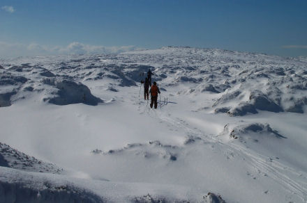
Chris beat us back to the cars, where GPs stats were compared. We'd
covered a respectable 18km over varied terrain, and felt quite pleased
with ourselves. Ian said that Sweden should be no problem - better
snow, no heather to fight, good tracks if we wanted to use them -
little did we know!
Sunday 3 March
The weather continued cold most of the week although there wasn't much
fresh snow. Jim and I decided to have another expedition as it was
likely to be our last chance before the Sweden trip. We set off as
before to Lady Cross but tried to follow the higher ground as far as
possible, heading east this time. The snow was not as friendly as
before, having thawed and refrozen to give an icier crust with much
less grip, but there were still no bare patches. From Featherbed Moss
we travelled along Howden Edge to Outer Edge and on to Margery Hill.
There were more people about but few white hares.
Jim played on the west slope of Margery Hill, messing about with skins
and harscheisen. I found the gradient daunting and could only descend
by traversing and kickturns - having got part way down I decided not to
bother. It's strange the way a slope changes in significance depending
on the means of descent. A slope that would hardly register on downhill
skis suddenly becomes much more scary on nordics (or on a snowboard, as
I found when we tried 'boarding in Canada). And the altered perception
can stay with you even when you revert to your "normal" method - it
took me a whole morning to get my ski-brain back after boarding.
We skied back along our tracks most of the way, not wanting to venture
into heather traps. We'd managed about 24km, not as much variety as the
previous weekend but a worthwhile day out. And we kept telling
ourselves that Sweden would be so much easier (ha ha).
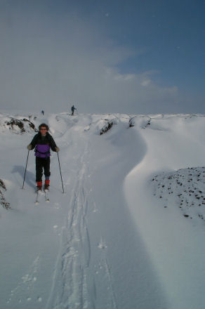
Sweden 2005
Ian has a contract to write up this trip so I won't spill too many
beans. Suffice to say:
1 We saw rather more of Stockholm than we had expected
- a beautiful city but not that enticing when you wish to be hundreds
of miles further north.
2 A sudden thaw before we actually got to Lapland made
for "interesting" skiing.
3 Klister should be avoided at all costs - to avoid
temptation, throw the stuff away!
4 We learned where Stalon and Nallo are.
5 It was wonderful!
2006
By late 2005 a group of us had booked a trip to the Pyrennees with
Exodus - doing it the easy way this time, with most meals provided so
packs can be lighter. Jim still has the same touring kit as last year
but he has fitted touring bindings to my alpine skis and I have
acquired other necessary gear from eBay. We hoped to get another
practice in locally so when we woke to a thick layer of the fluffy
stuff on Saturday 4 March we dashed off to Woodhead with high hopes.
Snow in Warrington is almost unheard of - so surely it would be magical
on the moor?
Wrong. Woodhead was barely covered, and what snow there was looked very
wet. A bit put out, we drove down to Glossop for some retail therapy,
only to find the snow thicker down there! After a tour of Magic
Mountain we headed up to Snake Pass instead - and found enough to ski
on.
Faffing exercises included me realising my bindings were still set up
for my alpine boots (different size), and Jim forgetting his camera
first time we left the van, so by the time we set off it was gone
midday. Our tour was therefore somewhat shorter than the previous
expeditions on these moors but still fun, and we were able to try out a
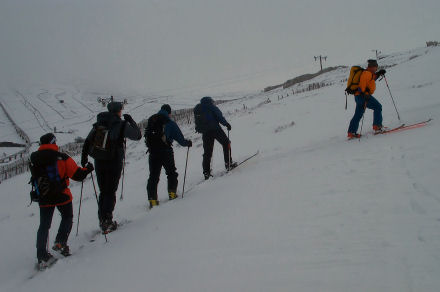
touch of wax and use our skins - great excitement. We ventured as far
as ....... Stones, then turned about and set off back to the van -
seeing dark clouds approach we thought it might snow again but nothing
materialised. Although the route to the stones had felt generally
uphill the return was somewhat lacking in much obviously downhill but
we did glide along quite nicely. Jim managed one faceplant and I
achieved a full sideways fall from which I struggled to get up (too
much laughing) but we broke no poles and snagged no heather. We upset a
few dogs who didn't like the skis, but that was about all.
Now we're packing rucksacks again for the trip to Pyrennees. I'm not
risking telling myself that it should be easier on my alpine skis than
on those skinny nordic things - anything could happen!
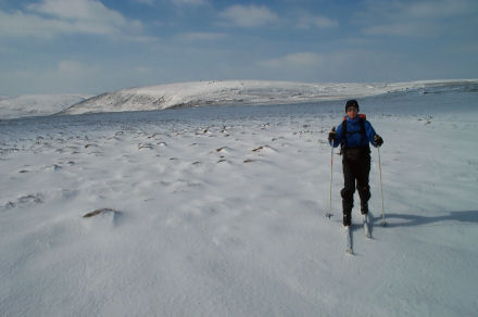
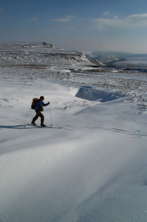
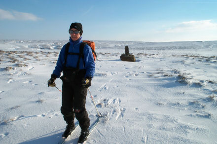
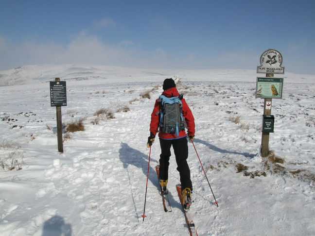
Ann
Kookery Korner - Spring
Rolls
Ingredients
Filo pastry (2 sheets per roll)
Chinese vegetables (packaged or bought separately)
Butter
Cooking oil
Utensils - What ever you can find in the hut
Firstly make sure the surfaces are clean. You don’t want any mice or
rat droppings in the mix, although it could add some texture.
Then lay out the filo pastry and gently with a knife cut in half. Add
vegetables into the middle of each piece (if you have brought fresh
ones make sure they are washed and chopped). Roll each end of the
pastry till it reaches the vegetables then roll it up making sure all
the vegetables are in the pastry. Add butter to stick it together and
then put it in a pan of hot oil. Leave until it is crispy and golden
brown.
WARNING – Do not leave unattended otherwise the hut might burn down and
people will be sleeping in their cars that night.
After making as many as you want, sit down and enjoy them with a beer
or glass of wine.
Abby Tuffs (age 14 ¼)
Great Shunner Fell -
Annual Dinner (25 February 2006)
Dave P, JT, Phil and I set off on a very wintry morning to park at
Hardraw above Hawes. We walked up a track to the west end of the
village signposted to Thwaite. We climbed up though walls and out onto
the open fell. The wind here was bitterly cold and getting stronger, it
was quite a challenge to walk upright. We took refuge in between some
mining ruins for a quick break before we continued up the fell. It was
a very long drag up the hill. Even though it was bitterly cold and
there was quite a lot of snow about the ground was not quite frozen.
The crossing of the bogs was helped though by the fact that this was
the Pennine way and most of it had been flagged. Once on the top of the
ridge we hid behind a low-lying cairn and put on all the clothes we
could muster. It was then a short walk to the top of Great Shunner Fell
(Big Lookout Fell, 2349ft). There was a nice windbreak / seat on the
summit which allowed us a reasonable break out of the wind.
Once fed we then left the Pennine Way and followed a fence southeast
across the pathless moor. The going was tough due to the snow on the
ground and it not being quite frozen. We followed the fence to the top
of Fossdale Gill then headed down the left side and made our way to the
cattle grid at the top of the pass. The guidebook said it was an easy
walk to the summit but we would disagree. It was quite a slog up and
near the summit we entered the clag. At the summit of Lovely Seat
(2215ft) there is in fact a lovely stone seat but unfortunately facing
directly into the wind that day. It now started to rain / sleet quite
heavily. We took a bearing and headed off across the rough moorland.
Due to the featureless terrain and clag we resorted to GPS to confirm
we were on the right track and after some time hit the bridleway marked
on the map. This is in fact now quite a substantial landrover track. We
turned left to skirt along the top of the cliffs until a bridleway
headed down to the valley. The ground here differed to the map as now
the new track continues along the ridge and is not marked on the map.
We climbed down the path in heavy rain and ended up at Sedbusk, from
here we followed a footpath though 18 narrow fields back to Simonstone
Hall and eventually back to Hardraw. It was a quick deboot and shake
off the worst of the wet for a pre-dinner warm by the fire and pint in
The Green Dragon before we headed back to The Station Inn for the
festivities.
Jacqui
Bothy Brew - Luib Chonnall
November and Lisa and myself set off for a weekend up North before the
congestion of December descended. Friday night it lashed it down on the
drive up and our destination for an overnight was Melgarve. The road to
it though had several very long & deep puddles that we managed to
negotiate, just, only to be stopped about half a mile from the road end
by a river that was now flooding over the road. So we did nothing more
than reverse onto a high spot and kip in the car for the night. The
next morning the rain had stopped, with the road having drained off.
Anyone walking by would have wondered why we had stopped there. What a
difference just a few hours makes.
Given the weather looked a bit better in the west we set off down to
Glen Roy to do one of the Cairn Dearg Corbett's (there are three in
about a 5 mile radius). It was a pleasant horseshoe round only taking a
few hours. Because of our height to the surrounding hills we stayed
free of the clag and had good views out to Loch Arkaig & out east
to the glen to Melgarve. Getting back early gave us plenty of time to
get packed up for the trip into Luib Chonnall, it's a straight forward
land rover track gradually incline most of the way until the last half
a mile which goes through a heathery / boggy section depending on the
line and conditions. We reached it in the last of the light and this is
another of those bothies that doesn't reveal itself until the very last
even though it is set out in the open.
The room is upstairs and was very amenable with armchairs and tables.
The estate uses it quite often, regularly dropping a load of timber in
for fuel, though we'd taken ours in. We ended up with the place to
ourselves and whiled away the evening in front of a good fire, while it
rained & blew outside.
The morning had cleared again and we set off for our walk in sun and
broken blue skies, a route that would take us back over the other Carn
Dearg's which are situated just behind the Bothy. A short pull up and
traverse brought us onto the rounded ridge leading to the first hill. A
fresh sprinkling off snow that had fallen last night gave a nice
aesthetic look to the hills which otherwise can look a little bland as
they are devoid of any real features. Descending to the bealach we
passed a couple of guys heading up to where we'd come from. Then a
climb out following a stream to a small knoll where a bearing was
necessary as the cloud had been slowly sneaking around and lowering to
smother the tops of our next hill. The top was reached but there wasn't
a lot of point hanging around so we set off following the red needle to
take us down to the ridge which would lead to the head of the Glen to
lead us back to the car. I think this area would make a good place for
the LAMM as there's plenty of up & down, relatively good under foot
to make it runable and the navigation would be interesting.
Alt Schechacan
A quick foray after Christmas. Unfortunately the snow that hit
everywhere dented initial ideas. However travelling up the A9 I decided
I'd stop at Blair and have a wander into Alt Schechacan. Parking up at
Old Tilt I loaded up with the usual gear then doubled my pack weight
with the coal, but there are some things you just don't go bothying
without in winter. The walk in is via land rover tracks and it was a
really nice clear cold evening with a rosy sunset setting to the west
behind Schehallion & Rannoch. I arrived at the Bothy already
knowing I had company being able to smell the fire down wind. Again she
doesn't show herself till the last bend on the track. My last visit was
with group of Whiterose caver's and a certain noisy Vib (I'll let you
guess who?) where we made music and carried on till the early hours.
How time flies eh! A convivial evening swapping tales and warming by
the fire was had by all. I was up and away early next morning heading
up and over the bealach below Beinn Dearg cross country to nip up the
back of a neighbouring Corbett which would then allow me to walk out
via Glen Tilt without having to return to the Bothy for any gear. A bit
of compass work was needed as from the col I entered that shrouded
world of the cloud and snow scape. In many ways I enjoy being out like
this in the back of beyond with just you and the elements. Needless to
say I saw no one all day and not much in the way of views until late on
as I walked out down the glen. I finished off with a trip to the Atholl
arms for a beer. Who are now serving the very credible Moulin Brewery
beers. Only a fleeting visit but enjoyable all the same.
Glen Dubh Lighe
A new year and a new Bothy for my first trip of the year. The place as
been around a while but was only taken on and done out by the MBA last
year. The weather was good on Saturday although there was a lack of the
white stuff below 650m. My route was to take the horseshoe round of the
Glen going up over Streap & back via Braigh nan Uamhachan. As are
the hills in the west a lot always seem to be steep pulls to start with
onto ridges and Streap was no exception, I tried to take the sting out
it by contouring in to a bealach though this in itself meant I had to
overcome obstacles such as little outcrops and gullies. On gaining the
ridge it lives up to its billing and there was just enough of a dusting
of snow to ensure interest as it narrows towards it true top. From
there I had good views down into Glen Pean and the hills towards
Knoydart. The way off goes over Streap Chomhlaidh from which a broad
ridge opens out with old fence posts along its line, until you descend
down to the Lochan a Chomhlain nestled between the two hills. Certainly
looks a good place for a spot of fishing. The climb out is steep and
the options are to either trend slightly north or south of the summit
to circumvate the small corrie below Uamhachan's top. If you have more
time or if you’re inclined the extension of Gulvain can be added as the
northern shoulder connects round to the summit of the latter and if the
clouds hadn't been swirling round its summit I might have done. As it
was I headed back over the pleasant undulating ridge which leads back
to the forests above the Bothy picking up a track which saved either
the steep descent into the glen mentioned in guidebooks or the thrash
through the plantation.
As the Bothy is still quite newly renovated it hasn't had chance to
become abused and the place was very well decked out tables, chairs and
the hearth worked well. Given it had been Burn's night during the week,
I did my bit and made haggis, neaps n' tatties for tea washed down with
a dram or two. Finishing off my book in front of a roaring fire.
Sunday I planned a walk from just around the corner to take in the two
Corbett's at the northeastern end of Loch Finnan; Sgurr Ghuibhsachain
& Sgorr Craobh a Chaorainn. My route involved a long approach to
get to the head of the Glen Cona from which I could traverse the ridge
back to the car. The initial walk was on an old stalkers path following
a river and small clusters of caledoian pines, before turning and
following an indistinct route to the top of Cona glen, where the path
petered out.There was the odd mossed covered cairn to be spotted and so
I added a few small cairns too to help give anyone following an idea of
the line to the bealach.
The route back is then fairly straight forward following the crest of
the ridge around with the old fence posts for company until you reach
the top of Ghuibhsachain. The snow of yesterday had gone replaced with
rime ice and the last 100m in cloud. Descending off I picked out a
fault line between the slabby crags which circle north of the top.
Eventually after a bit of zigging & zagging I came back to the
grass ridge below. The rest of the walk was easy going up and over the
various tops with the views out towards Fort William improving as time
went by. The Ben & Aonach's first appearing through an inversion
before the cloud completely disappeared.
Matt Davis
Images of the Bothies can be found on the website
www.mountainbothies.org.uk
Unfortunately the copyright is held by the individual photographers so
I can’t include them here - ed.
Phil had gone off on a last minute boys weekend away so I organised a
last minute weekend walk. Dave P, Alison, Andy, Stuart, Alan &
friend and I met at the car park at Digley reservoir. We walked on a
path above this reservoir then Bilberry reservoir whose dam once burst
in 1852 causing the death of 81 people. Luckily on a much calmer day we
continued up the track past the derelict Goodbent Lodge. Here we turned
left and crossed Marsden Clough and continued up over Good Bent and
Stopes Moor. The path met the Issues Road track and at its end we met a
reasonable path that took us up the hillside to meet the Pennine Way.
Once here we stopped for a break and to admire the views on the crisp
winter morning.
From here we turned left and continued along a well-paved path to the
summit of Black Hill (1908ft). Having never been here before I was most
impressed by the big black peat pits on either side of the path which
looked like they could swallow you whole and was very grateful to those
who had built the path. As we approached the summit the weather took a
turn for the worse and we were engulfed in a snowstorm. There was no
hanging about on the summit and we now had to leave the security of the
path and wind our way through the peat haggs and groughs in the thick
snow to the Holme Moss mast. Luckily the ground was frozen solid or it
could have been quite a nasty piece of navigation.
Once we hit the road we followed the border fence for about ¾
mile then climbed the fence and set off on a bearing for the top of
Ramsden Clough. This was quite a bash over rough heather with people
heading off on their own bearings following compasses and GPS’s (Stuart
following his nose, which proved not as reliable as a GPS!). The
weather had improved again and we were back to a glorious clear day.
Ramsden Clough was a very impressive hidden gem – it was a narrow
valley with rocky cliff sides. It has been kept from public view for
many years due to a git of a landlord but has now been opened up thanks
to the new access legislation.
We walked along the left-hand top until we picked a not too death
defying grass slope and carefully picked our way down. We met up at a
lovely old bridge in the valley bottom and had lunch next to a pretty
icicle encrusted waterfall. Once fed and rested we headed up the
hillside and past a variety of old machinery we could not work out what
it once was and had a very pleasant walk out along the top of the woods
with glorious views. We dropped down to hit Brownhill reservoir then
took convoluted paths through woods and around the reservoirs to end up
in Holme village. We had a quick stop in the pub then walked back to
the cars through the fields. A lovely unexpected day out with all
weathers and a lot healthier than Phil’s drinking weekend in Wales !
Jacqui
Alan, Dave P, Bridget (Thur evening to Sunday)
Martin Wright (Friday evening to Sunday)
Dave Stubbs and Kerry Bartle (Saturday evening only)
After a long detour via Mobberley to pick up Bridget, Dave's heavily
laden car arrived at the hut just before midnight.
Friday:
The three early arrivals were all up bright and early the next
morning, and found a convenient parking spot at the side of the A85 at
the end of the private road to Auchessan. We walked past the farm and
up the track, before turning left at a fence and following it up into
the Allt Essan valley. The snow lay crisp and white, and made breaking
trail difficult - there was about a 90% chance on each step that your
foot would break the crust and go down about a foot. After a while we
realised that we were heading too far west, and turned north up the
hillside following the tracks of a small herd of deer. We crossed the
ridge of Meall Garbh, and skirted round the bowl of the Allt Glas,
trying to keep to the ridges of hummocks where the slow lay
thinnest. After a steep scramble up a rather exposed craggy bit,
trying to avoid the slopes at greatest risk of avalanch, we reached a
ridge and found a set of footprints heading off up to the summit of
Meall Glas.
We had originally intended to follow the ridge to the north-east, drop
down to the col, and then bag Sgiath Chùil as well, but the icy
blast
coming down the ridge, in addition to our slow progress through the
snow, made us change our mind, so after a quick set of summit
photographs, we retraced our steps, then followed the other set of
footprints onwards to the south-east rather than back along our
original route to the south. They seemed to be heading too far to the
east, though, and we didn't want to follow the Allt Glas and the Allt
Riobain which would have taken us a km too far east, so we cut back
south, ploughing through the snow of the bowl of the Allt Glas,
softening in the afternoon sun.
Eventually, after many fences and gates, we got back to the car. We
had all underestimated the intensity of the sunlight on a clear,
blue-skied day in Scotland, even in March, and with the reflections
off the snow, all three of us ended up with red patches of sunburn on
those bits of our faces that weren't well wrapped up or behind
goggles.
On Friday night a few of us visited the local pub/hotel/restaurant:
the Ben More. As usual for Scotland, the beer was fizzy keg. The hut
was quite busy, with several members of the home team getting ready
for an early start on a winter skills course.
Saturday:
We had been joined by Martin the previous evening, and all packed into
his car to set off for the washed-out bridge at Edinample near
Lochearnhead. We parked up and crossed the river, following the road
for about 3.5km to Ardvorlich. We then followed a track up the valley,
pausing whilst a farmer on a quad with a bale of hay came down, and
then to let Martin take his clothes off - he was overheating. When we
reached the open hillside and the snow, Martin found it such hard work
that he had to retreat and do his own thing in the valley, whilst the
remaining three bagged Ben Vorlich. Dave had already got this summit
under his belt, and so we dropped down to the Bealach an Dubh Choirein
heading for Stùc a Chroin. The ascent up the north ridge was
very
steep, and we watched a party of two faffing about on it for some time
before retreating, so for the second time Dave had to miss bagging
the summit, and we retreated down Corrie Fhuadaraich, picking up a
well-made track, which however showed a great deal of evidence of the
floods which had washed out the bridge.
In the evening we were joined by Dave and Kerry, who had decided to
book beds at the local youth hostel, not knowing whether there would
be space left at the hut. There were also several members of a Glasgow
club, and a good time was had by all.
Sunday: Martin set off back to Inverness, so it was just Alan, Dave
and Bridget who set off for a second go at bagging Sgiath Chùil.
Some
of the snow at the lower altitudes had melted, but it was again hard
work slogging through the snow up to the summit. We were back down to
the car by 14:30, and after a quick shower and bite to eat back at the
hut, we were on the road to the south by 15:30, and back to Yorkshire
by 22:00.
Alan
1 – brown Pheonix bivi bag
single 80cm zip across shoulders, 2m long.
Material - unknown, soft lining inside.
pack size: 26cm long x 13cm diameter 610g
1 - green Gore Tex Survival bivi tent
includes: 2 poles and 12 pegs
features: zipped midge screen, 4 guy points
pack size: 39cm long x 15cm diameter 1100g
Contact: Ian Parker for further details / offers.
|
Contents
- Editorial
- Vibram News & Meets List
- Meet Report, Tan yr Wyddfa
- High Peak Marathon, Phil Roberts
- Meet Report, Stair
- Skitouring, Ann McGrath
- Kookery Korner, Abby Tuffs
- Annual Dinner Walk, Jacqui Tootill
- Bothy Brew, Matt Davis
- Day Meet, Black Hill, Jacqui
- Meet Report, Crianlarich, Alan Wylie
- Items for Sale
|
|